Portal:Senegal
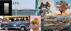
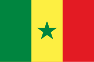
The Senegal PortalSenegal, officially the Republic of Senegal, is the westernmost country in West Africa, situated on the Atlantic Ocean coastline. Senegal is bordered by Mauritania to the north, Mali to the east, Guinea to the southeast and Guinea-Bissau to the southwest. Senegal nearly surrounds The Gambia, a country occupying a narrow sliver of land along the banks of the Gambia River, which separates Senegal's southern region of Casamance from the rest of the country. Senegal also shares a maritime border with Cape Verde. Senegal's economic and political capital is Dakar. Senegal is the westernmost country in the mainland of the Old World, or Afro-Eurasia. It owes its name to the Senegal River, which borders it to the east and north. The climate is typically Sahelian, though there is a rainy season. Senegal covers a land area of almost 197,000 square kilometres (76,000 sq mi) and has a population of around 18 million.0 The state is a unitary presidential republic; since the country's foundation in 1960, it has been recognized as one of the most stable countries on the African continent. On the 2023 V-Dem Democracy Indices, Senegal is ranked 52nd in electoral democracy worldwide and 4th in electoral democracy in Africa. The state was formed as part of the independence of French West Africa from French colonial rule. Because of this history, French is the official language, but it is understood by only a minority of the population. Over 30 languages are spoken in Senegal. Wolof is the most widely spoken one, with 80% of the population speaking it as a first or second language, acting as Senegal's lingua franca alongside French. Like other African nations, the country includes a wide mix of ethnic and linguistic communities, with the largest being the Wolof, Fula, and Serer people. Senegalese people are predominantly Muslim. Senegal is classified as a heavily indebted poor country, with a relatively low ranking on the Human Development Index (170th out of 191). Most of the population lives on the coast and works in agriculture or other food industries; other major industries include mining, tourism, and services. The country does not have notable natural resources, but the basis of its development lies in education,[clarify] where almost half the state's budget is spent. Senegal is a member state of the African Union, the United Nations, the Economic Community of West African States (ECOWAS), Organisation internationale de la Francophonie, the Organisation of Islamic Cooperation, and the Community of Sahel–Saharan States. In the world of motor sports, Senegal is known for the Paris–Dakar Rally. (Full article...) Selected article -
The British capture of Senegal took place in 1758 during the Seven Years' War with France, as part of a concerted British strategy to weaken the French economy by damaging her international trade. To this end, a succession of small British military expeditions landed in Senegal and captured Gorée and Fort Saint Louis, the French slave fort located at Saint-Louis, seizing French vessels and supplies. By late 1758 the whole of the French colony on the Senegalese coast had been captured by the British, with administrative matters being handled by the first (and only) British Governor of Senegal, Lieutenant Colonel Richard Worge. (Full article...)
Selected imagesSelected quotation -
Entries here consist of Good and Featured articles, which meet a core set of high editorial standards.
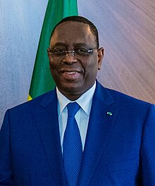
Carabane, also known as Karabane, is an island and a village located in the extreme south-west of Senegal, in the mouth of the Casamance River. This relatively recent geological formation consists of a shoal and alluvium to which soil is added by accumulation in the branches and roots of the mangrove trees which cover most of the island. Along with the rest of Ziguinchor Region, Carabane has a tropical climate, cycling between a dry season and a wet season. The island was once considered an arid location where no useful plants were likely to grow, but it now supports several types of fruit tree, the most common of which are mangos and oranges. Although the nearby Basse Casamance National Park and Kalissaye Avifaunal Reserve have been closed for years because of the Casamance Conflict, Carabane has continued to attract ornithologists interested in its wide variety of birds. Various species of fish are plentiful around the island, but there are very few mammals. The earliest known inhabitants of the island were the Jola, the ethnic group which is still the most populous on the island. The Portuguese were active in the region from the 16th century onwards; however, they did not linger on "Mosquito Island", the mosquitoes and black flies convincing them to establish their trading post in the town of Ziguinchor instead in 1645. On January 22, 1836, the island was ceded to France by the village leader of Kagnout in return for an annual payment of 196 francs. A series of treaties between the French and the leaders of the local peoples ensued; however, the inhabitants of Carabane did not recognize the authority of the treaties imposed upon them, resulting in lootings and abductions among French rice farmers by the Karoninka people. In 1869, Carabane became autonomous, but it merged with Sédhiou in 1886. Since World War II, the population of the island has gradually declined for a variety of reasons including periods of drought, the Casamance Conflict and, more recently, the sinking of the ferry Joola in 2002. Much of the village's ability to trade and receive tourists was lost until 2014, when MV Aline Sitoe Diatta resumed ferry services to the island. (Full article...)Selected biography -Macky Sall (French pronunciation: [maki sal], Wolof: Maki Sàll, Pulaar: 𞤃𞤢𞤳𞤭 𞤅𞤢𞤤, romanized: Maki Sal; born 11 December 1961) is a Senegalese politician who served as the 4th President of Senegal from 2012 to 2024. He previously served as the 8th Prime Minister of Senegal from July 2004 to June 2007, under President Abdoulaye Wade and President of the National Assembly from June 2007 to November 2008. Sall served as the Mayor of Fatick from 2002 to 2008 and held that post again from 2009 to 2012. He was a long-time member of the Senegalese Democratic Party (PDS). After coming into conflict with Wade, he was removed from his post as President of the National Assembly in November 2008; he consequently founded his own party named the Alliance for the Republic (APR) and joined the opposition. Placing second in the first round of the 2012 presidential election, he won the backing of other opposition candidates and prevailed over Wade in the second round of voting, held on 25 March 2012. He is the first president born after Senegalese independence from France. (Full article...)General imagesThe following are images from various Senegal-related articles on Wikipedia.
Did you know -
WikiProjects
Related portalsAssociated WikimediaThe following Wikimedia Foundation sister projects provide more on this subject:
Things you can do
Discover Wikipedia using portals | ||||||||


